Current despatch time is 3-5 days.Please contact us if you require faster delivery. Dismiss
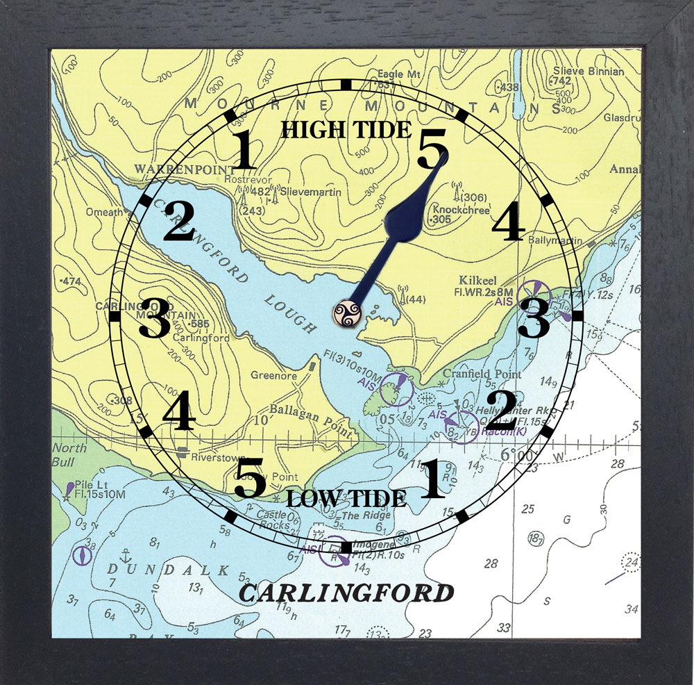
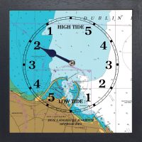
Skip to contentThis solid wood framed chart tide clock shows the area from Dundalk Bay to the Mourne mountains
Carlingford Lough (Irish: Loch Cairlinn; Ulster Scots: Carlinford Loch or Cairlinfurd Loch is a glacial fjord or sea inlet that forms part of the border between Northern Ireland to the north and the Republic of Ireland to the south. On its northern shore is County Down and on its southern shore is County Louth. At its extreme interior angle (the northwest corner) it is fed by the Newry River and the Newry Canal.
The name is derived from the Old Norse Kerlingfjǫrðr, which means “narrow sea-inlet of the hag”. Historically it was called Cuan Snámh-Aighneach, Snámh-Aighneach or Cuan Cairlinne in Irish. An older English name was Nury (Newry) Bay.
The lough is navigable, and its seaward entrance is marked by the Haulbowline Lighthouse, which was built in 1824.There is a deep water cargo port at Greenore, and a smaller fishing harbour at Carlingford.A commercial marina lies north of Carlingford town, close to the start of the greenway.
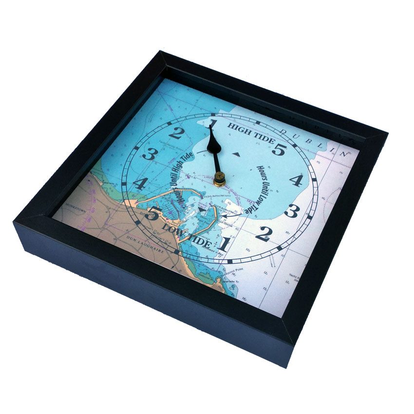
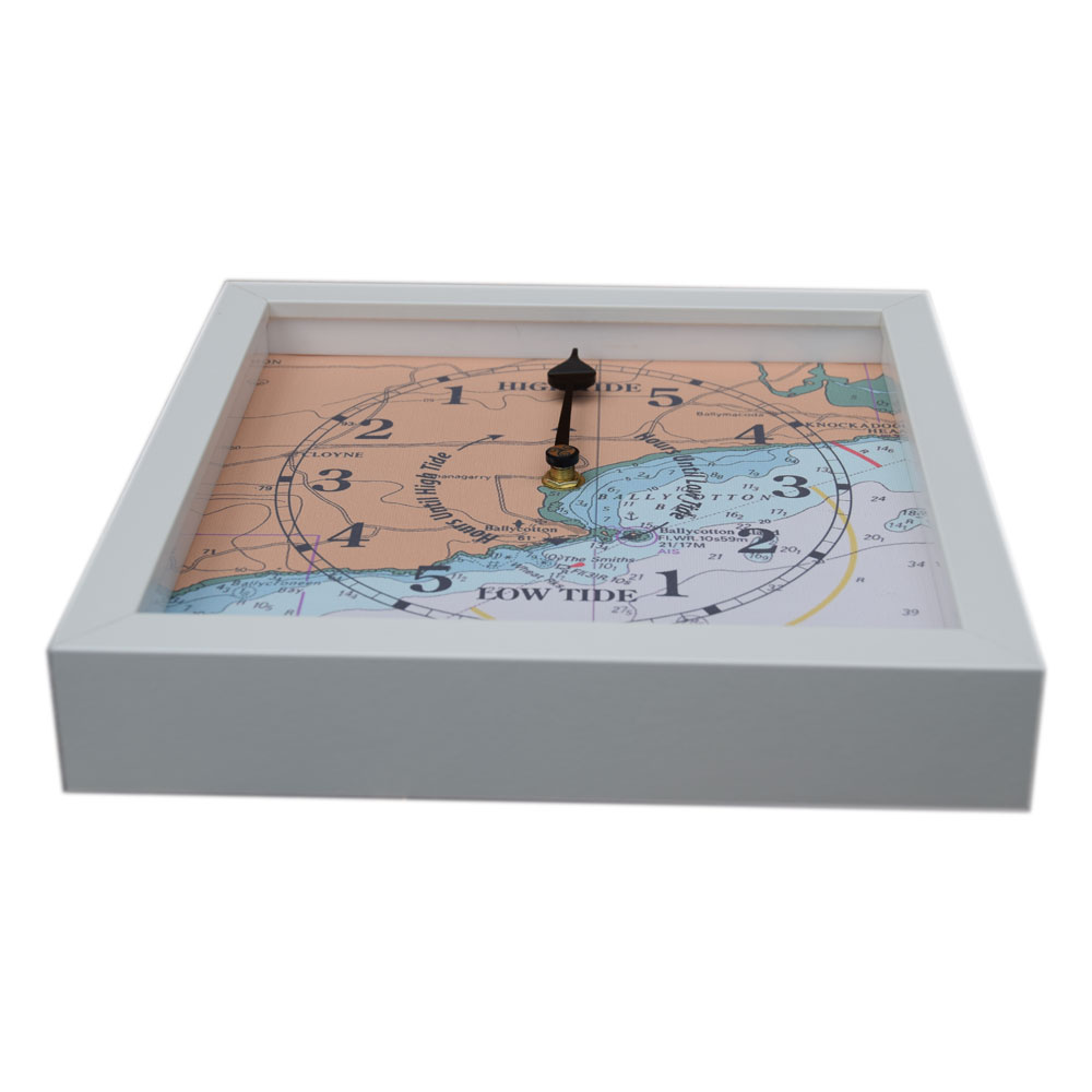
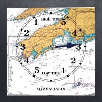
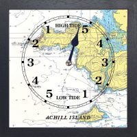
A tide clock allows you to see the state of the tide for a given location at a glance.The hand shows the current stage of the tidal cycle (high tide, low tide or on the way in or out). The tide clock face is simple to read and setting the hand can be done in a matter of minutes.Never leave the house again without knowing the state of your local tide!
The clocks feature:
The clock ships with full instructions on how to set and how to read a tide clock.
This is not a navigation device.
€65.00
“We received the tide clock this week and it is so fantastic, so beautiful! We love it. We just hit high tide on a full moon 5 min ago and I set it! Thank you thank you thank you and hope you are all doing well. I also was very excited to get a package from Ireland. That was half the fun!”
JF
“ I just received the tide clock that I ordered today, and I just wanted to say thank you! The service was so prompt, and the clock is amazing. It was great to find a gift for my husband who is very hard to buy for! He and my eldest daughter love to go fishing in the summer, so this will be very useful. Thanks again! .”
ML